Agentic Lidar Archaeology: 5 Myths, Tested
An AI agent pipeline flagged a Maya site in lidar data overnight. We test 5 myths of agentic lidar archaeology and what the verification loop really does.
 Sarah Chen
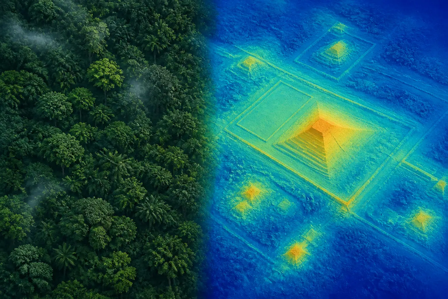
Forty-eight AI agents scanned 1,200 km² of jungle lidar overnight and flagged a Maya civic centre that wasn't in Mexico's official archaeological register. Then the uncomfortable part happened: it turned out archaeologists had already mapped that exact site in a 2025 paper, and the agents — and their human — had missed it in the literature search. That story, in miniature, is everything you need to know about agentic lidar archaeology: the discovery pipeline genuinely works, and the verification loop genuinely doesn't, unless you build it properly.
I've spent years building ML pipelines where the cost of a false positive was a paged engineer, not a misreported archaeological site. So let me take the five beliefs I keep seeing about this kind of agentic discovery pipeline and test each one against what actually happened.
Myth 1: You Need a Custom-Trained Model to Find Ruins
The most surprising detail in the whole story: there was no special model involved. No CNN trained on labelled pyramid tiles, no fine-tuned detector. The pipeline converted lidar strips into hillshade-style images and had general-purpose vision-language agents look at them one by one, following a written guide describing what pyramids, platforms, and plazas look like versus hills, sinkholes, and roads.
This works because frontier vision models have effectively absorbed a huge amount of visual prior knowledge. A levelled plaza with straight edges under a jungle canopy is an anomaly-detection problem, and modern VLMs are decent anomaly spotters when you give them clean rendered inputs. The trick isn't the model — it's the rendering. Lidar point clouds are useless to a vision model directly; you have to convert them into something legible: digital terrain models, hillshades with multiple sun angles, slope maps. Get the visualisation right and a generalist model becomes a surprisingly competent surveyor.
That said, this is a frontier I'll defend with caveats. For high-volume production work, a specialist classifier still wins on cost and consistency — we've covered the trade-off in specialist CNNs vs frontier LLMs for image classification before. Running 48 agent sessions over a thousand-plus image tiles is expensive and non-deterministic. But for exploration, where you're generating hypotheses rather than operating a service? The generalist-plus-good-prompt approach is pragmatically correct, and it costs nothing in labelled training data — which for niche archaeology tasks barely exists anyway.
Verdict: busted, with an asterisk. You don't need a custom model to generate candidates. You probably do want one if this becomes a repeated, scaled operation.
Myth 2: The Agents Did the Discovering
Read the timeline closely and you see what the agents actually did: they filtered. The discovery itself was made years earlier by the airborne lidar crews, the researchers who published on reusing environmental lidar for archaeology, and specifically the authors of the 2025 survey paper who had already mapped this very hilltop. The agents compressed the search space from 1,200 km² of jungle to a handful of candidate tiles a human could inspect over coffee.
That's not a knock — filtering at that scale is the actual bottleneck in most data-rich sciences. Radio astronomy, particle physics, genomics: the pattern is always the same. Sensors produce far more data than humans can look at, so discovery rate is limited by triage throughput, not by data availability. This is exactly the dynamic behind why AI benchmarks miss most real work — the valuable task was never "be smart," it was "look at a million boring things and surface the five interesting ones."
Verdict: mostly busted. Agents are force multipliers for attention, not sources of discovery. The moment you frame them as discoverers, you start trusting their negative results — "the literature search found nothing" — and that's where this story's failure mode lives.

Myth 3: A Vision Agent's Straight Edges Are Ground Truth
Here's the part of the pipeline I found most technically sound. After a vision agent flagged the hilltop, the workflow didn't stop at the rendered image. It went back to the raw point cloud and checked that the ground-classified returns (as opposed to canopy returns) actually traced the plaza, pyramid, and courtyard — under 10–17 metres of forest. This is the single most important habit in any geospatial ML pipeline: renderings lie, points don't.
Why the paranoia? Ground classification in lidar processing is itself a model, and under dense tropical canopy it can interpolate smooth surfaces where it has almost no real returns. A "plaza" can be an artefact of the ground-finding algorithm hallucinating flatness. Vegetation structure can also produce eerily linear canopy gaps that propagate into hillshades. Anyone who has worked with country-scale geodata pipelines has been burned by processing artefacts that look more meaningful than the signal.
So the verification checklist I'd insist on, and which this story mostly followed:
- Confirm the feature in the raw point cloud, sliced along at least two axes — not just in a rendered DTM.
- Render with multiple hillshade azimuths; artefacts from scan-line direction vanish or move, real structures don't.
- Cross-check against a second data source if one exists (different survey, different year).
- Filter known false-positive generators: sinkholes (the Maya region is karst, full of them), modern roads, logging scars, and geological terraces.
- Quantify the anomaly: edge straightness, corner angles, platform area versus regional background. "Looks rectangular" is a vibe; a measured aspect ratio is a claim.
The pipeline passed most of these. And notably, the physical claim held up — the site is real, archaeologists agree it's a Classic-period civic centre. The failure happened on a completely different axis.
Myth 4: Checking the Literature Is a Task You Can Delegate
This is the myth the story busted on itself, in public. The agents searched the literature and the official INAH register, found nothing, and reported the site as unregistered. Technically true — it wasn't in INAH's register. But a peer-reviewed paper published that same year had mapped the site, and the agentic literature search sailed right past it. "Rediscovery" entered the headline only after a domain expert pointed at the citation.
If you've built agents that do any kind of prior-art or novelty checking, this should make you wince with recognition. Literature search is the hardest thing to delegate, for structural reasons:
- Coverage is invisible. An agent can't tell you what it couldn't access — paywalled journals, PDFs behind university repositories, papers where the site appears as one coordinate in a table on page 14. Which is exactly where this site was.
- Negative results are unfalsifiable. "I found nothing" looks identical whether nothing exists or your search was shallow. There's no error signal.
- Fresh publications lag every index. A 2025 paper may be poorly indexed, unpicked-up by search tools, or known only through conference talks and preprint servers.
- Spatial matching is its own problem. Papers don't always publish coordinates; sites have multiple names; a figure caption says "hilltop near X" and the map is a low-res raster. Matching your candidate to that requires actual reasoning over geography.
My rule from production ML work: agents can generate candidate claims, but the novelty claim — "nobody has reported this" — is the one output you verify manually, with the deepest search you can muster, before it leaves the building. The geospatial side has an analogous trap with coordinate and boundary systems; anyone who's dealt with spatial indexing trade-offs knows that "is this point in this dataset" is never as simple as it sounds.
Verdict: busted, hard. Physical verification delegated well in this story. Novelty verification delegated terribly. Design your pipeline accordingly: automate the search, but treat "no prior work found" as a draft, never a conclusion.
Myth 5: The Verification Loop Is One Step
The useful way to read the whole 72-hour arc is as a layered verification design, where some layers held and one collapsed. It's worth naming the layers because they're the same ones you'd build for any agentic claim-generation system:
- Layer 1 — Sensor-level check. Does the raw data support the rendered feature? (Point cloud slices. Passed.)
- Layer 2 — Independent agent review. Different agents, different prompts, re-examine candidates; disagreement routes to the human. (Mostly passed; no published evidence of adversarial prompting, which I'd add.)
- Layer 3 — External authority. Query the official register — INAH confirmed nothing registered. (Passed, but only proved register absence, not novelty.)
- Layer 4 — Prior-art search. (Failed — missed the 2025 survey paper.)
- Layer 5 — Domain expert. Ultimately provided by the community and the original authors, after publication. (This is the layer that caught the error.)
The lesson isn't "don't trust agents" — it's that each layer verifies a different claim, and passing three of five tells you nothing about the other two. Layer 3 passing was actively misleading here, because "not in the register" got promoted to "not known to science" in the human's head. That's a join error across two datasets with different coverage, and it's the same class of bug as assuming a ZIP code boundary means what you think it means — the kind of thing we dig into in ZCTA vs USPS boundary mismatches. Two authoritative-seeming sources, silent disagreement, confident wrong conclusion.
Every layer of a verification stack checks a different claim. Passing three layers tells you nothing about the fourth.
If I were hardening this pipeline, I'd add two cheap mechanisms. First, an adversarial literature pass: a separate agent whose only job is to disprove novelty, given more aggressive search tooling and instructions to assume prior work exists. Second, a pre-publication expert ping — send the candidate list to one actual domain specialist before announcing anything. The community response here shows experts are willing to engage fast; the correction arrived within hours of the post going up.

What the Rediscovery Actually Proves
I'll defend the outcome, though, because I think the sceptics got the failure analysis wrong. An outsider with a laptop and some compute independently converged on the same site that a professional survey published — using public data, in a couple of nights of agent time. If your triage pipeline rediscovers known sites, that's a calibration signal, not an embarrassment: it means the detector has real sensitivity. You'd worry much more if it surfaced only things nobody could ever confirm.
The replicable recipe, stripped of the adventure narrative:
- Pick a domain where public sensor data vastly exceeds human attention (lidar is the canonical case; NASA's Earth science archives are another).
- Convert raw data into high-quality visual renderings — this step matters more than model choice.
- Fan out cheap vision agents with a precise written rubric of positives and known false positives.
- Verify survivors against raw data, not renderings.
- Treat novelty as a separate, human-led verification track, and route claims through a domain expert before announcing.
There's one more thing the archaeology community raised that's worth sitting with: discovery is no longer the bottleneck — stewardship is. Sites that are found faster than they can be excavated or protected become looting targets, and coordinates are sensitive information (the report author was right to put them in a confidential annex). If you build discovery pipelines over sensitive domains, build the disclosure policy first. Verification isn't only about being right; it's about being right responsibly.
The honest summary: agentic pipelines over public geospatial data can absolutely generate real, verifiable claims, and the vision-model-as-surveyor trick works better than most practitioners expected. But the claim that survives is the one whose verification loop was designed for the layer that fails silently. In this story, the lidar checks sang and the literature check whispered. Build for the whisper.